Top

Hiking path: From the meadows of the Croda Rossa to the Passo Monte Croce

Sexten
Add to favourites
Category
Difficulty
Easy
Activity time
1:30
Duration in hours
Distance
5.6
Distance in km
Suggested period
Jan
Feb
Mar
Apr
May
Jun
Jul
Aug
Sep
Oct
Nov
Dec

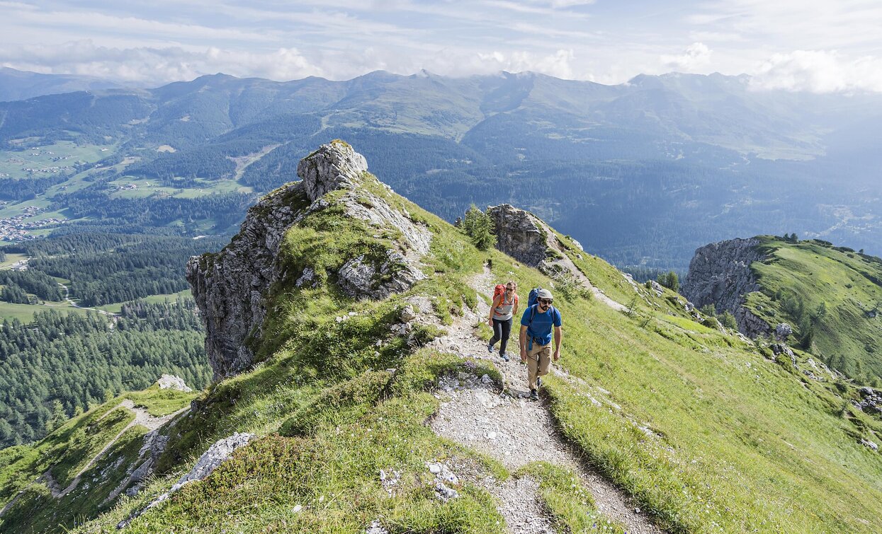
An extremely scenic, six-kilometre high-altitude trail that follows old war trails and can also be recommended to less experienced mountain hikers, especially as the ascent can be done by lift and the way back by bus. The good trail leads from the Rotwand meadows, partly at the tree line, partly above it at the foot of vertical rockfalls, almost flat to the Kreuzberg Pass. From the path there are beautiful views of the Carnic ridge and the ice peaks of the Rieserferner group to the north. 

Route info
Easy
Distance
5,6 km
Activity time
1 h 30 min
Ascent
41 m
Descent
270 m
Physical effort
Scenary
Highest point
1.636 m
Lowest point
1.310 m
Directions

From Moos/Moso we walk at the right at the curch of Moso to the Café Kofler and across the meadows to the funicular of the Croda Rossa. We take the lift and arrive at an altitude of 1950m. Here starts the excursion on the path nr. 15. The path starts flat and arrives in a short wood and than follows under the rocks of the Croda Rossa, the Peak Nine (Neuner) and the Arzalpenkopf. Along the entire path you can see many rests of the World War I. The last piece of the path goes down to the Hotel Kreuzbergpass crossing the ski slope. Now you can take the bus to Moso or walk on the way nr. 13A next to the river and way 1 back to Moos/Moso.

public transportation
By bus to the Rotwand
How to get there

By car or bus to Sesto, then to Moos to the valley station of the Rotwand/Croda Rossa cable car.

Where to park
At the Rotwand cable car
You might be interested in
Discover related tours
Toblach
Summer walk around: Rienz/Rienza - Gratsch/Grazze - "Grieswaldile"
Distance 4,3 km
Activity time 1 h 30 min
Ascent 58 m
Descent 58 m
Sexten
Hiking path: Moso – Gasthof Froneben
Distance 1,5 km
Activity time 25 min
Ascent 215 m
Descent 215 m
Pragser Tal
Summer hiking tour - Lago di Braies/Pragser Wildsee - Rifugio Biella/Seekofelhütte
Distance 6,1 km
Activity time 3 h 09 min
Ascent 954 m
Descent 105 m
Toblach, Pragser Tal, Niederdorf
Summer hiking tour - Braies Vecchia/Altprags - Moutain "Monte Serla/Sarlkofel"
Distance 4,9 km
Activity time 3 h 08 min
Ascent 1.010 m
Descent 59 m
Pragser Tal
Summer hiking tour - Lago di Braies/Pragser Wildsee lake - Malga Cavollo hut
Distance 6,6 km
Activity time 2 h 56 min
Ascent 846 m
Descent 158 m
Toblach
Summer hiking tour: Schluderbach/Carbonin - Monte Piano
Distance 3,5 km
Activity time 3 h 00 min
Ascent 906 m
Descent 48 m