Top

38 High altitude circuit Plätzwiese high plateau

Pragser Tal
Add to favourites
Category
Difficulty
Easy
Activity time
1:58
Duration in hours
Distance
6.5
Distance in km
Status
Closed
Suggested period
Jan
Feb
Mar
Apr
May
Jun
Jul
Aug
Sep
Oct
Nov
Dec
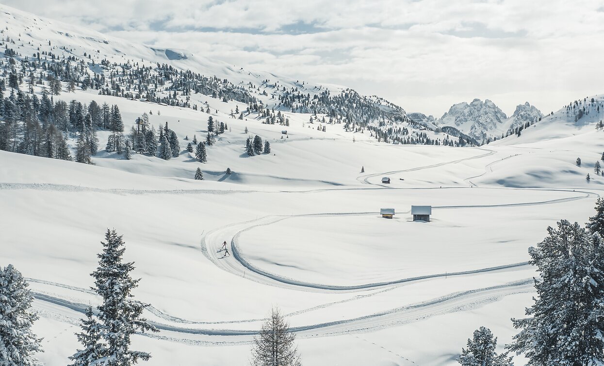
Enjoy the silence and nature combined with a stunning view of some of the famous peaks of the Dolomites ( Hohe Gaisl/Corda Rossa, Cristallo and Tofane).

On the 2000 Plätzwiese high plateau in the middle of the Fanes-Sennes-Prags nature park, where many cross country stars have used this circuit to prepare for Olympic gold, the excellent snow conditions offer wonderful hours on cross country skies. This unique circuit is also recommended for beginners and enthusiasts. Here, where the snowy days tend to start before the first days of December and sometimes last until the last days of March, you can experience peace and nature combined with stunning views of some of the famous peaks of the Dolomites (Hohe Gaisl peak, Monte Cristallo and the Tofane).

Route info
Easy
Distance
6,5 km
Activity time
1 h 58 min
Ascent
197 m
Descent
199 m
Technical skills
Physical effort
Scenary
Highest point
2.031 m
Lowest point
1.954 m
Directions
Start and ending point: Plätzwiese high plateau
public transportation
Accessible by public transport. The timetable is are aviabile on the website https://suedtirolmobil.info/en/
How to get there

Valley entrance Braies – road junction to Plätzwiese/Prato Piazza – continue until Ponticello. From Ponticello until Plätzwiese/Prato Piazza there is a traffic Regulation from Dezember until April (drive up is possible until 10 am and after 3 pm) – attention: snow tire or snow chains are obligated. Shuttle service available.

Where to park
Parking area to Plätzwiese/Prato Piazza high plateau
You might be interested in
Discover related tours
county ski Alta Pusteria Hochpustertal San Candido Innichen | © Tourismusverband Hochpustertal, San Candido
Intermediate
Add to favourites
Toblach, Innichen
13 San Candido/Innichen chairlift Haunold/Baranci - direction Toblach/Dobbiaco (forest)
Distance 7,0 km
Activity time 1 h 40 min
Ascent 45 m
Descent 33 m
Status
Closed
Val di Landro/Höhlensteintal | © © TvToblach/H.Wisthaler, Dobbiaco
Intermediate
Add to favourites
Toblach
11 Toblach/Dobbiaco: Gemärk/Cimabanche - Cross country stadium Nordic Arena (variant)
Distance 17,3 km
Activity time 2 h 52 min
Ascent 132 m
Descent 449 m
Status
Closed
Toblach
01 Cross country ski run illuminatedat the stadium of Toblach/Dobbiaco
Distance 2,3 km
Activity time 33 min
Ascent 31 m
Descent 31 m
Status
Closed
Pragser Tal, Niederdorf
31 Niederdorf/Villabassa - from Niederdorf/Villabassa train station to Welsberg/Monguelfo
Distance 6,0 km
Activity time 1 h 16 min
Ascent 76 m
Descent 145 m
Status
Closed
Pragser Tal
35 Circle at Schmieden/Ferrara
Distance 2,0 km
Activity time 25 min
Ascent 32 m
Descent 32 m
Status
Closed
Sexten
19 SEXTEN - Circuito Prato Larici
Distance 4,1 km
Activity time 1 h 03 min
Ascent 97 m
Descent 97 m
Status
Closed