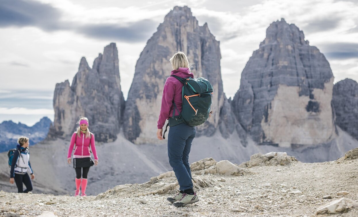
Dolomites UNESCO Geotrail - Stage 10: from the Dreizinnen Hut to Sesto/Sexten

Toblach, Sexten
Add to favourites
Category
Difficulty
Difficult
Activity time
4:17
Duration in hours
Distance
15.6
Distance in km
Status
Closed
Suggested period
Jan
Feb
Mar
Apr
May
Jun
Jul
Aug
Sep
Oct
Nov
Dec

The Geotrail crosses Dolomites of South Tyrol in ten days, traversing some of the most beautiful and geologically interesting mountain ranges in the region. This stage is from the Dreizinnen hut to Sexten/Sesto.


Route info
Difficult
Distance
15,6 km
Activity time
4 h 17 min
Ascent
298 m
Descent
1.405 m
Physical effort
Scenary
Highest point
2.563 m
Lowest point
1.302 m
Directions

The way to the Büllelejoch Pass is signposted from the Dreizinnen Hut. Continue downwards on Path no. 101. Below to the right can be seen the Bödenseen lakes. The path continues pleasantly below the Paternkofel/Paterno, finally ascending to the Büllelejoch Pass. At the col turn left (signposted) and shortly after taking a path carved through the rock you reach the Büllelejoch Hut. From here the path to the Oberbachernjoch Pass and the Zsigmondy-Comici Hut is signposted. Continue past the rocks along Path no. 101 to the Oberbachernjoch Pass and descend to the Zsigmondy Hut. Now begins the long descent into the Fischleintal Valley (Path no. 103 – signposted). Pass the Talschluss Hut and continue to the Dolomitenhof where there is a bus stop. Instead of walking to Sesto, you can take the bus from here. Otherwise, turn left directly after the Fischleinboden Hut (signposted 1A) and follow the path to Sesto.

You might be interested in
Discover related tours
Alpine Hike | © Tourismusverein Sexten_H.Wisthaler, Sesto
Intermediate
Add to favourites
Sexten
Alpine tour: On the Seikofel/ Monte Covolo
Distance 12,8 km
Activity time 3 h 56 min
Ascent 562 m
Descent 267 m
Helm/Monte Elmo | © H.Wisthaler TVB, Sesto
Intermediate
Add to favourites
Sexten
Mountain Hike: Helm/ Monte Elmo
Distance 5,1 km
Activity time 2 h 41 min
Ascent 1.068 m
Descent 1.068 m
east Gsell hike | © Tourismusverein Sexten_H.Wisthaler, Sesto
Intermediate
Add to favourites
Innichen, Sexten
Alpine tour: Western "Gsell"
Distance 20,8 km
Activity time 4 h 30 min
Ascent 850 m
Descent 850 m
Hochebenkofel | © Tourismusverein Innichen, San Candido
Intermediate
Add to favourites
Toblach, Innichen
Alpine Tour: Hochebenkofel/Cima Piatta Alta Peak
Distance 8,0 km
Activity time 10 h 00 min
Ascent 1.392 m
Descent 0 m
Status
Closed
Toblach, Sexten
Alpine tour: The Three-hut-hike
Distance 17,1 km
Activity time 8 h 00 min
Ascent 1.200 m
Descent 1.200 m
Status
Closed
Sextner Stein | © Harald Wisthaler, Sesto
Intermediate
Add to favourites
Toblach, Sexten
Alpine tour: Ski tour Sasso di Sesto/Sextner Stein
Distance 6,7 km
Activity time 3 h 30 min
Ascent 1.085 m
Descent 1.085 m