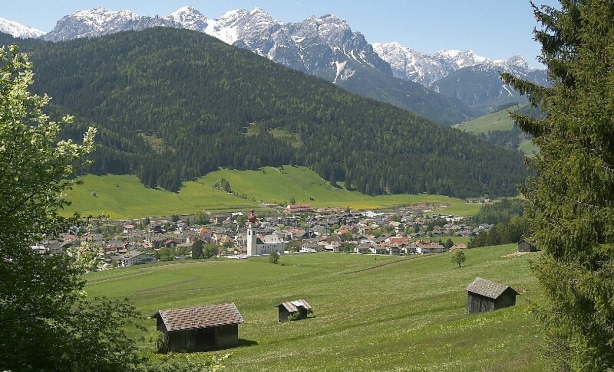
Family hiking tour: Niederdorf - Aufkirchen - Toblach - Niederdorf

Toblach, Niederdorf
Add to favourites
Category
Difficulty
Easy
Activity time
4:30
Duration in hours
Distance
10.7
Distance in km
Suggested period
Jan
Feb
Mar
Apr
May
Jun
Jul
Aug
Sep
Oct
Nov
Dec

The walk begins in Niederdorf/Villabassa at Von Kurz Square. From there, it follows well-marked paths towards Aufkirchen/Santa Maria, an idyllic village with traditional houses and magnificent panoramic views. The highest point of the hike is at 1,300 meters, where you can take a break to enjoy the impressive view of the South Tyrolean mountain landscape.

There is now an alternative route for the way back: instead of returning directly to Niederdorf/Villabassa, the path leads via Toblach/Dobbiaco. Here you follow route no. 11B, which descends slightly and runs through forests and meadows. Toblach/Dobbiaco is ideal for a short stopover before returning to Niederdorf/Villabassa via the same route or by public transport. This variant extends the hike and offers additional scenic variety.

Route info
Easy
Distance
10,7 km
Activity time
4 h 30 min
Ascent
600 m
Descent
800 m
Physical effort
Scenary
Highest point
1.320 m
Lowest point
1.154 m
You might be interested in
Discover related tours
Pfannhorn | © @TVToblach, Dobbiaco
Intermediate
Add to favourites
Toblach
Summer hiking tour: Kandellen/Gandelle - Pfannhorn/Corno Fana
Distance 5,4 km
Activity time 3 h 00 min
Ascent 1.075 m
Descent 4 m
Pragser Tal, Niederdorf
Summer hiking tour - Corte - Larici - Villabassa/Säge - Lercha - Niederdorf
Distance 4,0 km
Activity time 1 h 03 min
Ascent 48 m
Descent 109 m
Toblach, Innichen, Sexten
Hike: Val campo di Dentro- Forcella del lago (2.545 m) - Valle di Landro Innerfeld - Lückeleschartl 2.545 m - Höhlensteintal
Distance 15,9 km
Activity time 5 h 30 min
Ascent 989 m
Descent 989 m
Innichen
Family hike: Source of the Drava (Drau) River
Distance 2,4 km
Activity time 45 min
Ascent 39 m
Descent 23 m
Status
Closed
Prato Piazza | © @TVToblach, Dobbiaco
Intermediate
Add to favourites
Toblach, Pragser Tal
Summer hiking tour: Gemärk/Cimabanche - Plätzwiese/Prato Piazza
Distance 4,5 km
Activity time 2 h 00 min
Ascent 494 m
Descent 25 m
Monte Pra della Vacca | © Steiner Erwin, Braies
Intermediate
Add to favourites
Pragser Tal
Summer hiking - Lago di Braies/Pragser Wildsee - Mountain "Monte Pra della Vacca/Kühwiesenkopf"
Distance 3,4 km
Activity time 2 h 01 min
Ascent 641 m
Descent 0 m