to the cable cars
Top

Family hiking tour: Niederdorf/Villabassa - Mooskircherunde/Passeggiata "Mooskirche" circuit - Niederdorf/Villabassa

Niederdorf
Add to favourites
Category
Difficulty
Easy
Activity time
0:38
Duration in hours
Distance
2.5
Distance in km
Suggested period
Jan
Feb
Mar
Apr
May
Jun
Jul
Aug
Sep
Oct
Nov
Dec
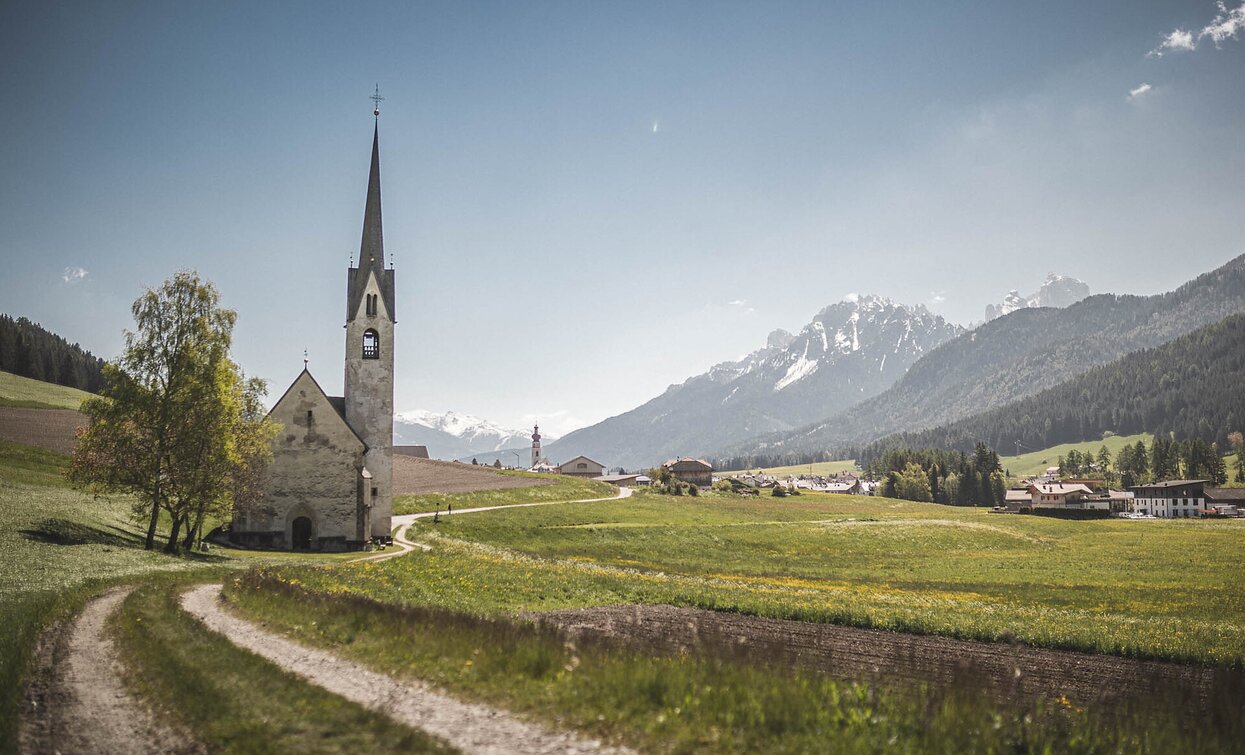
Family-friendly walk from Niederdorf’s Church to the charming Moos Church with Dolomite views. Gentle, easy return along a peaceful field path.

The walk begins in the center of Villabassa, at the small historic Spitalkirche (Church), marking the start of a scenic and peaceful route.

From there, the trail leads along the edge of the forest toward the picturesque Mooskirche – with continuous views of the village of Villabassa and the impressive mountain backdrop of the Braies Dolomites.

Once you reach your destination, you’ll find the small Gothic church of St. Magdalena im Moos, also affectionately known as the Mooskirche. The peaceful surroundings and nearby benches invite you to pause, take a deep breath, and soak in the special atmosphere of this tranquil place.

The return path follows a quiet, paved road surrounded by open fields – a relaxing end to this panoramic and gentle walk.

Tags
  • Family-friendly
Route info
Easy
Distance
2,5 km
Activity time
38 min
Ascent
21 m
Descent
21 m
Physical effort
Scenary
Highest point
1.157 m
Lowest point
1.136 m
public transportation

Niederdorf/Villabassa is easily accessible by public transport, such as buses and trains. Timetables are available at https://suedtirolmobil.info/en/

How to get there

The starting point is located in the center of Niederdorf. It is easily accessible by public transport: https://suedtirolmobil.info/en/

Where to park
A recommended parking area in Niederdorf/Villabassa is located at the western entrance to the village (“West Entrance”).
You might be interested in
Discover related tours
Pragser Tal
Summer hiking - Monguelfo - Lago di Braies
Distance 11,3 km
Activity time 3 h 25 min
Ascent 479 m
Descent 74 m
Path to the Lärchenhütte hutm | © © Tourismusverein Sexten, Sesto
Intermediate
Add to favourites
Sexten
Hike: Haus der Berge - to the Lärchenhütte hut
Distance 3,9 km
Activity time 1 h 55 min
Ascent 537 m
Descent 0 m
Sexten, Innichen
Hike: top of Mt. Elmo - San Candido
Distance 10,5 km
Activity time 3 h 00 min
Ascent 23 m
Descent 905 m
Sexten
Hike: Moos – Froneben agritourism
Distance 1,3 km
Activity time 40 min
Ascent 208 m
Descent 0 m
Innichen, Sexten
Hike with buggy: Sexten - Innerfeldtal valley
Distance 5,1 km
Activity time 1 h 45 min
Ascent 367 m
Descent 0 m
Pragser Tal
Summer hiking - Parking space Prato Piazza/Plätzwiese - Rif. Vallandro/Dürrensteinhütte
Distance 2,0 km
Activity time 32 min
Ascent 40 m
Descent 0 m