to the cable cars

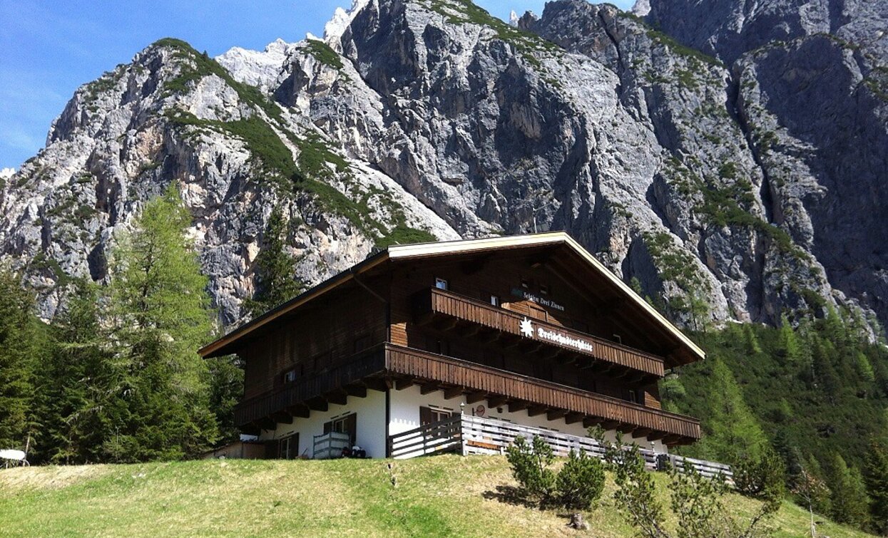
Hike: Rifugio Tre Scarperi/Dreischusterhütte Mountain Hut

Sexten, Innichen
Add to favourites
Category
Difficulty
Intermediate
Activity time
3:30
Duration in hours
Distance
11.3
Distance in km
Suggested period
Jan
Feb
Mar
Apr
May
Jun
Jul
Aug
Sep
Oct
Nov
Dec

Probably one of the nicest hikes in the San Candido/Innichen region. Its main attraction is the wonderful peaks of the Sexten Dolomites that tower over the whole of the Innerfeldtal valley. The area is also part of the Drei Zinnen Nature Park and is therefore a place of special beauty and tranquillity. The destination for this hike is the Dreischusterhütte mountain hut, which is open from June to the beginning of October and also has accommodation. The hike is relatively easy with no particularly difficult sections.

Tags
  • Family-friendly
Route info
Intermediate
Distance
11,3 km
Activity time
3 h 30 min
Ascent
369 m
Descent
369 m
Physical effort
Scenary
Highest point
1.626 m
Lowest point
1.257 m
Directions

Either park your car at the first parking area at the entrance to the Innerfeldtal valley and/or travel by bus to the terminus in the valley. From there, continue on foot along the forest road towards the Dreischusterhütte mountain hut. In some places this route takes you on hiking trails through the forest. Alternatively it is possible to do almost the entire route on asphalt roads.

public transportation
Getting to the starting point of the tour by public transport is possible (bus number 446 to the bus stop "Abzw. Innerfeldtal / Bivio Val Campo di Dentro" and bus number 449 to "Antoniusstein").
How to get there

By car or by bus. Drive to San Candido in the Val Pusteria/Pustertal Valley and in the direction of Sesto. Between San Candido and Sesto on the right side there is the Val Campo di Dentro/Innerfeldtal Valley. At the valley entrance there is a parking.

You might be interested in
Discover related tours
Toblach
Summer hiking tour: Schluderbach/Carbonin - Monte Piano
Distance 3,5 km
Activity time 3 h 00 min
Ascent 906 m
Descent 48 m
Lake Prags/Braies - Herrenstein | © Kotter Steger, Braies
Intermediate
Add to favourites
Pragser Tal
Summer hiking - Lago di Braies/Pragser Wildsee - Mountain "Sasso del Signore/Herrenstein"
Distance 4,0 km
Activity time 2 h 21 min
Ascent 739 m
Descent 80 m
Helm, starting point of the multi-day hike | © 3 Zinnen Dolomites - Harald Wisthaler, Sesto
Intermediate
Add to favourites
Sexten, Innichen
Mountain hike: Carnic Alpine Ridgeway (Karnischer Höhenweg)
Distance 36,7 km
Activity time 8 h 30 min
Ascent 1.000 m
Descent 1.000 m
Toblach
Summer walk around: Rienz/Rienza - Gratsch/Grazze - "Grieswaldile"
Distance 4,3 km
Activity time 1 h 30 min
Ascent 58 m
Descent 58 m
Erth pyramid | © © TvToblach, Dobbiaco
Intermediate
Add to favourites
Toblach
Summer hiking tour to the earth pyramid and view of the Three Peaks
Distance 4,1 km
Activity time 2 h 09 min
Ascent 655 m
Descent 0 m
Toblach, Niederdorf
Family hiking tour: Villabassa/Niederdorf – Santa Maria/Aufkirchen
Distance 3,4 km
Activity time 2 h 00 min
Ascent 600 m
Descent 600 m