to the cable cars

Hike: Western round Gsellwiesen meadows

Innichen, Sexten
Add to favourites
Category
Difficulty
Intermediate
Activity time
4:10
Duration in hours
Distance
10.7
Distance in km
Suggested period
Jan
Feb
Mar
Apr
May
Jun
Jul
Aug
Sep
Oct
Nov
Dec

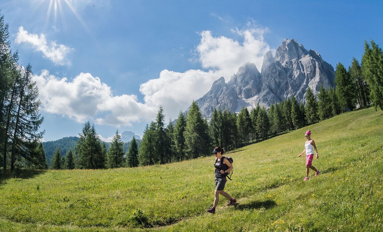
If you are looking for solitude and want to enjoy nature and its sea of flowers to the full, the western circuit of the Gsell mountain is highly recommended. It can be walked either directly from the centre of Sexten or from the Innerfeldtal valley.


Route info
Intermediate
Distance
10,7 km
Activity time
4 h 10 min
Ascent
735 m
Descent
735 m
Physical effort
Scenary
Highest point
2.005 m
Lowest point
1.271 m
Suggestions
Take enough provisions with you, as there are no refreshment stops
Directions

The start is in the centre of Sexten. Walk past the Sparkassa (path no. 12A) along the asphalt path until you reach the forest. At the intersection, follow the signpost for Innergsell. The moderately steep path takes you via serpetines through the peaceful forest directly to the Innergsell meadows. Continue along the path and cross the scree field below the Gsell in the direction of Außergsell until you reach a fork in the path. There you will find the signpost for Innerfeldtal valley, via which the descent begins. The descent is quite steep and only suitable for experienced hikers. Once you have completed the descent, follow the signs to Sexten and walk back to the starting point.

public transportation
Easy to reach by public transport
Where to park
Parking facilities in the centre
You might be interested in
Discover related tours
Toblach
Summer hiking tour: View of the Three Peaks/Landro - Drei Zinnen Hütte/Rifugio Locatelli hut
Distance 7,8 km
Activity time 3 h 30 min
Ascent 973 m
Descent 27 m
Lake Prags/Braies - Herrenstein | © Kotter Steger, Braies
Intermediate
Add to favourites
Pragser Tal
Summer hiking - Lago di Braies/Pragser Wildsee - Mountain "Sasso del Signore/Herrenstein"
Distance 4,0 km
Activity time 2 h 21 min
Ascent 739 m
Descent 80 m
Path to the Lärchenhütte hutm | © © Tourismusverein Sexten, Sesto
Intermediate
Add to favourites
Sexten
Hike: Haus der Berge - to the Lärchenhütte hut
Distance 3,9 km
Activity time 1 h 55 min
Ascent 537 m
Descent 0 m
Pragser Tal
Summer hiking - Parking space Prato Piazza/Plätzwiese - Rif. Vallandro/Dürrensteinhütte
Distance 2,0 km
Activity time 32 min
Ascent 40 m
Descent 0 m
Sexten
Walk: Moos - Sexten circular trail - Hennstoll hut
Distance 2,0 km
Activity time 40 min
Ascent 136 m
Descent 23 m
Hike to the Lärchenhütte hut | © ©Wisthaler Harald, Sesto
Intermediate
Add to favourites
Sexten
Hike: Sexten - Lärchenhütte hut
Distance 5,4 km
Activity time 1 h 55 min
Ascent 542 m
Descent 0 m