to the cable cars
Top

Snowshoe hike: Ski tour trail

Sexten
Add to favourites
Category
Difficulty
Intermediate
Activity time
2:10
Duration in hours
Distance
3.2
Distance in km
Status
Closed
Suggested period
Jan
Feb
Mar
Apr
May
Jun
Jul
Aug
Sep
Oct
Nov
Dec
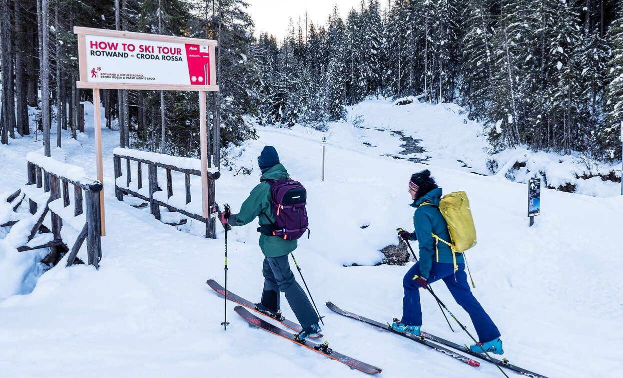
The first ski mountaineering adventure trail in South Tyrol

ATTENTION: Snowshoe hikes and ski tours should only be undertaken by experienced and well-trained mountaineers. Always consider the avalanche risk – carrying complete avalanche safety equipment (avalanche transceiver, probe, and shovel) is mandatory. Check the avalanche report and weather conditions before every tour. Those without sufficient experience should only join such tours in the company of a certified mountain guide.

Route info
Intermediate
Distance
3,2 km
Activity time
2 h 10 min
Ascent
551 m
Descent
551 m
Physical effort
Scenary
Highest point
1.986 m
Lowest point
1.435 m
Directions
The starting point of the ski touring trail is behind the restaurant at the valley station of the Drei Zinnen cable car. From there, you pass the entrance portal and head into the forest towards the Kreuzberg Pass. The trail is equipped with numerous information boards covering important topics such as risk management, walking and kick turn techniques, and avalanche hazards. After about 600 meters, you cross hiking trail no. 13A and reach a fork in the trail. There, follow trail no. 152 over a small bridge towards Rotwandwiesen. The trail leads through a short stretch of forest before crossing the main road and branching off slightly to the left into the forest on the opposite side. Now you walk gently uphill for about 1 km on partly groomed paths and partly open terrain until you pass the valley station of the “Porzen” chairlift. Various learning stations are built into the route, which provide practical information on technique and safety in the terrain. This is followed by an ascent through the forest, with a few bends next to the ski slope. After a total of about 6 km and 550 meters of elevation gain, you reach the mountain station of the “Porzen” chairlift (1,977 m) and thus the Rotwandwiesen.

The descent is on skis via the slope or, alternatively, for snowshoe hikers, via the same route back down to the valley.
public transportation
Line 446, Signaue bus stop; alternatively, line 440 during peak season
How to get there
Coming from the Puster Valley, turn off at Innichen into the Sexten valley. Coming from the Kreuzberg Pass, follow the main road to the Signaue parking lot. Start at the Signaue parking lot. (Valley station of the cable car)
Where to park
Parking available at the Signaue parking lot (cable car valley station).
You might be interested in
Discover related tours
Snowshoe hiking | © @TVToblach, Dobbiaco
Intermediate
Add to favourites
Toblach
Snowshoe-hike tour: Frondeigen/Franadega - Golfen/Monte Calvo
Distance 5,4 km
Activity time 2 h 30 min
Ascent 838 m
Descent 9 m
Status
Closed
Pragser Tal
Snowshoe hike - St. Veit/ San Vito - Wöggenalm hut
Distance 2,5 km
Activity time 1 h 04 min
Ascent 309 m
Descent 10 m
Status
Closed
Altprags - Putzalm | © Auer Lukas, Braies
Intermediate
Add to favourites
Pragser Tal, Niederdorf
Snowshoe hike - Braies Vecchia/ Altprags - Malga Putz/ Putzalm
Distance 2,4 km
Activity time 1 h 12 min
Ascent 363 m
Descent 56 m
Status
Closed
Innichen
Winter hike: Wildbad Springs - Riese Haunold Hütte Mountain Hut
Distance 8,5 km
Activity time 2 h 30 min
Ascent 380 m
Descent 73 m
Snowshoe hike: Pfandleck | © Harald Wisthaler, Sesto
Intermediate
Add to favourites
Sexten
Snowshoe hike: Pfandleck
Distance 6,1 km
Activity time 2 h 30 min
Ascent 407 m
Descent 82 m
Status
Closed
Toblach
Snowshoe-hiking tour: View of the Three Peaks/Landro - Rienztal/Valle della Rienza
Distance 3,6 km
Activity time 1 h 30 min
Ascent 253 m
Descent 2 m
Status
Closed