to the cable cars
Top

Snowshoe-hiking tour: Ratsberg/Monte Rota - Mellaten/Melate

Toblach
Add to favourites
Category
Difficulty
Easy
Activity time
3:00
Duration in hours
Distance
3.5
Distance in km
Status
Closed
Suggested period
Jan
Feb
Mar
Apr
May
Jun
Jul
Aug
Sep
Oct
Nov
Dec
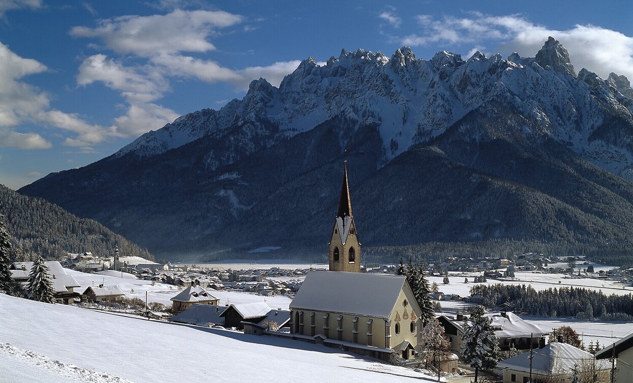
The hike leads up to the Ratsberg panoramic mountain, from where you have an optimal view of the Dolomite peaks, and there is also a place to stop for refreshments.

The snowshoe hike on the sunny side of Toblach/Dobbiaco offers a beatiful view over the Höhlensteintal/Landro valley and the Toblach/Dobbiaco lake.

IMPORTANT: Before starting any ski tour/snowshoe excursion, you must check the weather conditions and danger avalanches report (https://avalanche.report), asking also experts (alpine guides etc.).

Route info
Easy
Distance
3,5 km
Activity time
3 h 00 min
Ascent
251 m
Descent
75 m
Physical effort
Scenary
Highest point
1.818 m
Lowest point
1.585 m
Suggestions
2 cars
Directions

The easy snowshoe hike starts at the car park at the Alpenhotel Ratsberg, from which a well-marked path leads through winter forest terrain in a westerly direction. The Römerweg/Via dei Romani leads first slightly uphill, then slightly downhill to Mellaten, which is located above Toblach/Dobbiaco.
Attention: the start and end points are not the same.

public transportation
Not accessible by public transport.
How to get there

How to reach Toblach/Dobbiaco: https://www.drei-zinnen.info/en/dobbiaco/dobbiaco/contact-and-service/arrival-mobility.html

From Toblach in north-western direction to Aufkirchen/Santa Maria and further on to Ratsberg/Monte Rota.

Where to park

Parking places are available.

You might be interested in
Discover related tours
Pragser Tal
Snowshoe hike - Brückele/Ponticello - Großer Jaufen/Giovo Grande
Distance 7,2 km
Activity time 3 h 15 min
Ascent 982 m
Descent 982 m
Status
Closed
Innichen, Sexten
Snowshoe hike: Cappella del bosco/Waldkapelle Chapel - Baita del Cacciatore/Jägerhütte Mountain Hut - Sesto
Distance 13,8 km
Activity time 4 h 30 min
Ascent 634 m
Descent 512 m
Toblach
Snowshoe-hiking tour: Höhlensteintal/Val di Landro - Baumgartner Kaser
Distance 2,5 km
Activity time 1 h 45 min
Ascent 340 m
Descent 0 m
Status
Closed
Sexten
Snowshoe hike: Sexten - Außergsell
Distance 6,3 km
Activity time 3 h 55 min
Ascent 703 m
Descent 703 m
Status
Closed
high plateau Plätzwiese - Strudelkopf | © Auer Lukas, Braies
Intermediate
Add to favourites
Toblach, Pragser Tal
Snowshoe hike - Plätzwiese high plateau - Strudelkopf peak
Distance 4,1 km
Activity time 1 h 28 min
Ascent 359 m
Descent 42 m
Status
Closed
Altprags - Putzalm | © Auer Lukas, Braies
Intermediate
Add to favourites
Pragser Tal, Niederdorf
Snowshoe hike - Braies Vecchia/ Altprags - Malga Putz/ Putzalm
Distance 2,4 km
Activity time 1 h 12 min
Ascent 363 m
Descent 56 m
Status
Closed