Top

Snowshoe-hiking tour: View of the Three Peaks/Landro - Rienztal/Valle della Rienza

Toblach
Add to favourites
Category
Difficulty
Easy
Activity time
1:30
Duration in hours
Distance
3.6
Distance in km
Status
Closed
Suggested period
Jan
Feb
Mar
Apr
May
Jun
Jul
Aug
Sep
Oct
Nov
Dec
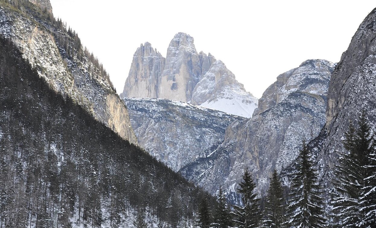
The hike leads into the Rienztal and always offers an optimal view of the famous Three Peaks.

This simple snowshoe hike does not lead directly up to the Three Peaks, but they are always in view from the start of the tour.

IMPORTANT: Before starting any ski tour/snowshoe excursion, you must check the weather conditions and danger avalanches report (https://avalanche.report), asking also experts (alpine guides etc.).


Route info
Easy
Distance
3,6 km
Activity time
1 h 30 min
Ascent
253 m
Descent
2 m
Physical effort
Scenary
Highest point
1.655 m
Lowest point
1.404 m
Directions

The easy snowshoe hike starts at the View of the Three Peaks/Landro in the Höhlensteintal/Val di Landro valley and leads along the path no. 102 amidst the snow-covered forest slightly uphill into the Rienztal/Valle della Rienza valley. Shortly after the hunting lodge, when the terrain becomes steeper, the end of the tour is reached and the way back is via the same way.

public transportation

Accessible by public transport. The timetables are available on www.sii.bz.it.

How to get there

How to reach Toblach/Dobbiaco: https://www.drei-zinnen.info/en/dobbiaco/dobbiaco/contact-and-service/arrival-mobility.html

From Toblach in southern direction until the View of the Three Peaks/Landro.

Where to park

Parking places are available.

You might be interested in
Discover related tours
Pragser Tal
Snowshoe hike - Brückele/Ponticello - Kleiner Jaufen/Giovo Piccolo
Distance 5,7 km
Activity time 2 h 40 min
Ascent 881 m
Descent 881 m
Status
Closed
high plateau Plätzwiese - Strudelkopf | © Auer Lukas, Braies
Intermediate
Add to favourites
Toblach, Pragser Tal
Snowshoe hike - Plätzwiese high plateau - Strudelkopf peak
Distance 4,1 km
Activity time 1 h 28 min
Ascent 359 m
Descent 42 m
Status
Closed
Pragser Tal
Snowshoe hike - St. Veit/ San Vito - Wöggenalm hut
Distance 2,5 km
Activity time 1 h 04 min
Ascent 309 m
Descent 10 m
Status
Closed
Sexten
Snowshoe: Schussriedl/ Cima dei Colesei
Distance 1,6 km
Activity time 2 h 45 min
Ascent 160 m
Descent 160 m
Status
Closed
Bonner Hut | © @TVToblach, Dobbiaco
Intermediate
Add to favourites
Toblach
Snowshoe-hiking tour: Kandellen/Gandelle - Bonner hut
Distance 3,9 km
Activity time 2 h 30 min
Ascent 711 m
Descent 0 m
Status
Closed
Innichen
Winter hike: Wildbad Springs - Riese Haunold Hütte Mountain Hut
Distance 8,5 km
Activity time 2 h 30 min
Ascent 380 m
Descent 73 m