Top

Summer hiking tour: Lückerleschartl/Forcella del Lago - Hochebenkofl/Cima Piatta Alta

Toblach, Innichen
Add to favourites
Category
Difficulty
Difficult
Activity time
1:00
Duration in hours
Distance
1.5
Distance in km
Status
Closed
Suggested period
Jan
Feb
Mar
Apr
May
Jun
Jul
Aug
Sep
Oct
Nov
Dec
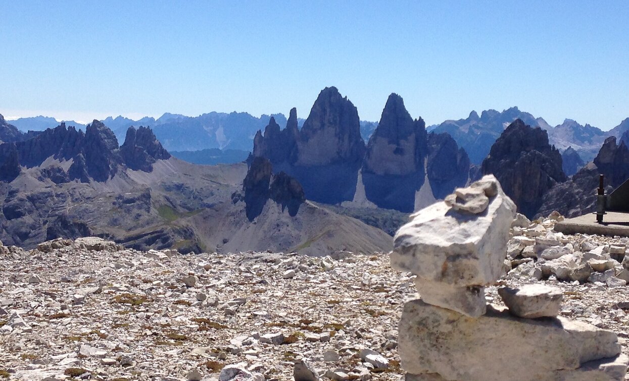
The Cima Piatta Alta is the second highest mountain in Dobbiaco.

The Hochebenkofl/Cima Piatta Alta is the second highest mountain in Toblach/Dobbiaco, which can be reached without climbing. From there you can reach the highest mountain without climbing on a very exposed path, the Birkenkofel/Cima del Baranci, in about 15 minutes.

Route info
Difficult
Distance
1,5 km
Activity time
1 h 00 min
Ascent
381 m
Descent
0 m
Physical effort
Scenary
Highest point
2.902 m
Lowest point
2.520 m
Directions

From the Lückeleschartl/Forcella del Lago takes a very exposed path which is also partially provided with a rope to the Hochebenkofl/Cima Piatta Alta.

Look the summer hiking tour: Höhlensteintal /Val di Landro- Lückeleschartl/Forcella del Lago to arrive to the Lückeleschartl.

public transportation

Accessible by public transport. The timetables are available on www.sii.bz.it.

How to get there

How to reach Toblach/Dobbiaco: https://www.drei-zinnen.info/en/dobbiaco/dobbiaco/contact-and-service/arrival-mobility.html

From Toblach in southern direction. About 300 m after the fravel factory (left) there is the parking place at the right side.

Where to park

Parking places are available.

You might be interested in
Discover related tours
Sexten
Hiking path: From the meadows of the Croda Rossa to the Passo Monte Croce
Distance 5,6 km
Activity time 1 h 30 min
Ascent 41 m
Descent 270 m
Innichen, Sexten
Family path with buggy: Olperl alpine circuit for families
Distance 3,2 km
Activity time 1 h 00 min
Ascent 242 m
Descent 157 m
Innerfeldtal valley | © TV Sexten, Sesto
Intermediate
Add to favourites
Innichen, Sexten
Mountain hike: Crossing Innerfeldtal/ Val Campo di Dentro - Fischleintal/ Val Fiscalina
Distance 11,6 km
Activity time 4 h 25 min
Ascent 210 m
Descent 210 m
Lake Prags/Braies - Herrenstein | © Kotter Steger, Braies
Intermediate
Add to favourites
Pragser Tal
Summer hiking - Lago di Braies/Pragser Wildsee - Mountain "Sasso del Signore/Herrenstein"
Distance 4,0 km
Activity time 2 h 21 min
Ascent 739 m
Descent 80 m
Sexten
Family Hike: Moso – Fischleintal Valley – Talschlusshütte Hut
Distance 4,7 km
Activity time 1 h 31 min
Ascent 168 m
Descent 168 m
Pragser Tal, Niederdorf
Family hiking tour - Corte - Larici - Villabassa/Säge - Lercha - Niederdorf
Distance 4,0 km
Activity time 1 h 03 min
Ascent 48 m
Descent 109 m