Top

Summer hiking tour to the earth pyramid and view of the Three Peaks

Toblach
Add to favourites
Category
Difficulty
Intermediate
Activity time
2:09
Duration in hours
Distance
4.1
Distance in km
Suggested period
Jan
Feb
Mar
Apr
May
Jun
Jul
Aug
Sep
Oct
Nov
Dec
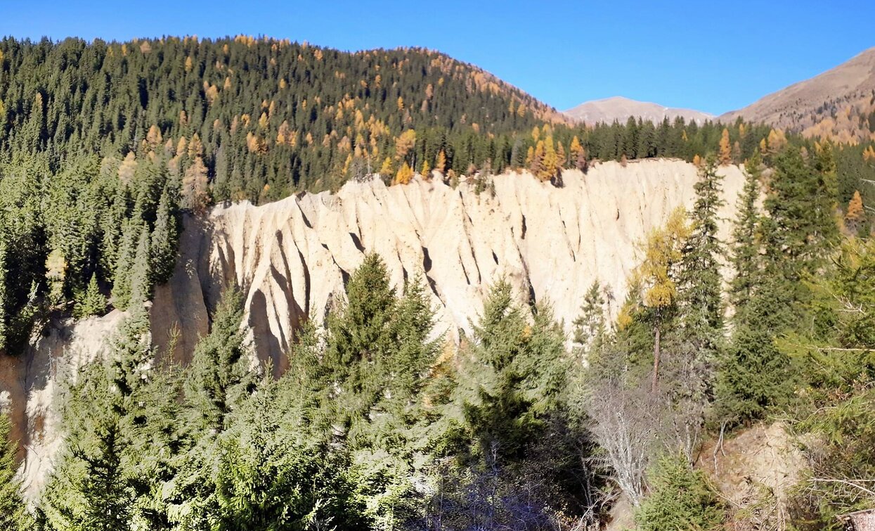
The hike offers two special features, on the one hand the earth pyramids which are of geological importance and on the other hand an unforgettable view of the Three Peaks.

This hike offers a wonderful view of the earth pyramids of Dobbiaco. The material of the earth pyramids dates back to the last Ice Age. The pyramids were created during a storm in 1834. During the hike you also have the opportunity to take a look at the famous Three Peaks.

Route info
Intermediate
Distance
4,1 km
Activity time
2 h 09 min
Ascent
655 m
Descent
0 m
Physical effort
Scenary
Highest point
2.141 m
Lowest point
1.485 m
Directions

The hiking tour starts at Wahlen/San Silvestro which is a fraction of Toblach/Dobbiaco. It is possible to park the car at the "Schönegger Säge". First, the hike leads on the track no. 1 into the Silverstertal/Valle San Silvestro valley. At the second junction on the left, the forest path no.5a leads to the earth pyramids. From there, the forest path continues slightly uphill. Just before the end of the tour, the forest path turn into a narrower path that leads to the "Hühnerspiel", where you can admire the Three Peaks.

From there it is possible to continue to Rifugio Bonner/Bonnerhütte hut or to the Malga Steinberg/Steinbergalm hut.

public transportation
Not accessible by public transport.
How to get there

How to reach Toblach/Dobbiaco: https://www.drei-zinnen.info/en/dobbiaco/dobbiaco/contact-and-service/arrival-mobility.html

From Toblach in northern direction, passing the district Wahlen/San Silvestro, until the end of the road.

Where to park

Parking places are available.

You might be interested in
Discover related tours
Toblach, Innichen
Summer hiking tour: Lückerleschartl/Forcella del Lago - Hochebenkofl/Cima Piatta Alta
Distance 1,5 km
Activity time 1 h 00 min
Ascent 381 m
Descent 0 m
Dobbiaco/Toblach | © © TvToblach, Dobbiaco
Intermediate
Add to favourites
Toblach, Innichen
Summer hiking tour: Neutoblach/Dobbiaco Nuova - Elsler Kaser - Innichen/San Candido
Distance 8,2 km
Activity time 2 h 30 min
Ascent 454 m
Descent 478 m
Status
Closed
Sexten, Toblach
Mountain hike: Hut Tour -- Zsigmondy, Büllelejoch and Dreizinnenhütte
Distance 17,7 km
Activity time 6 h 30 min
Ascent 1.233 m
Descent 1.233 m
Gsell | © Harald Wisthaler, Sesto
Intermediate
Add to favourites
Innichen, Sexten
Hike: Western Gsell/ Monte Casella
Distance 15,0 km
Activity time 5 h 35 min
Ascent 645 m
Descent 645 m
Status
Closed
Innichen, Sexten
Hiking path with buggy: Sesto - "Alte Säge"
Distance 3,0 km
Activity time 35 min
Ascent 40 m
Descent 40 m
Lake Prags/Braies - Herrenstein | © Kotter Steger, Braies
Intermediate
Add to favourites
Pragser Tal
Summer hiking - Lago di Braies/Pragser Wildsee - Mountain "Sasso del Signore/Herrenstein"
Distance 4,0 km
Activity time 2 h 21 min
Ascent 739 m
Descent 80 m