to the cable cars

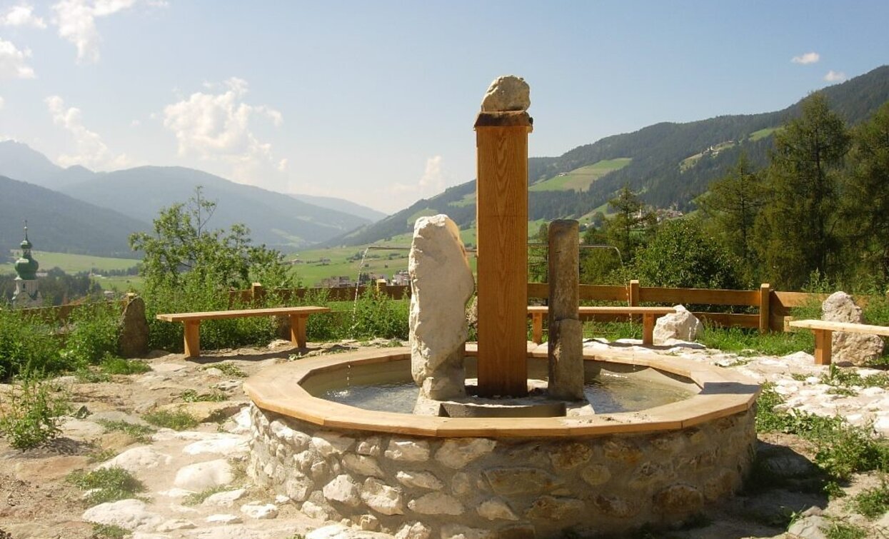
Summer hiking tour: Toblach/Dobbiaco - Fontanta "ZweiWasserBrunnen" - labyrinth

Toblach
Add to favourites
Category
Difficulty
Easy
Activity time
2:00
Duration in hours
Distance
3.3
Distance in km
Suggested period
Jan
Feb
Mar
Apr
May
Jun
Jul
Aug
Sep
Oct
Nov
Dec
The hiking trail is particularly suitable for families.

The Fountain "ZweiWasserBrunnen" and the Labyrinth are part of the Water treasures of Dobbiaco/Toblach.
At the Fountain "ZweiWasserBrunnen" you can taste the two waters of Dobbiaco/Toblach.
The Labyrinth has a bubbler in the center as power source.

Further information to the water treasures of Dobbiaco: www.three-peaks.info/en/dobbiaco/dobbiaco/experiencing-dobbiaco/lago-di-dobbiaco-and-dobbiaco-water-treasures.html?_ga=1.204887893.455846822.1385385320

suitable for baby stroller

Route info
Easy
Distance
3,3 km
Activity time
2 h 00 min
Ascent
182 m
Descent
66 m
Physical effort
Scenary
Highest point
1.353 m
Lowest point
1.237 m
Directions

From the village center, the trail no. 1 on the right side past the parish church, leads in the direction of the Haselsberg/Costa Noesllari. After about 20 minutes, the path reaches an idyllic view point above Toblach/Dobbiaco, where the fontain "ZweiwasserBrunnen" is located.
To continue to the labyrinth you have to go back to the center. From there, a hiking trail leads in northeast direction, passing the district Wahlen/San Silvestro, to the "KraftQuelleLabyrint", just after the Enzianhütte/Rifugio Genziana hut on the right.

public transportation

Accessible by public transport. The timetables are available on www.sii.bz.it.

How to get there
Where to park

Parking places are available.

You might be interested in
Discover related tours
Toblach
Summer hiking tour: Höhlensteintal/Val di Landro valley - Lückerleschartl/Forcella del Lago
Distance 5,3 km
Activity time 3 h 00 min
Ascent 1.280 m
Descent 90 m
Baranci | © Kottersteger, San Candido
Intermediate
Add to favourites
Innichen
Hike: Pausa Ganda/Gantraste Peak
Distance 11,3 km
Activity time 4 h 30 min
Ascent 951 m
Descent 951 m
Toblach, Innichen, Sexten
Hike: Circuit Hike Schwabenalpenkopf peak
Distance 18,8 km
Activity time 6 h 50 min
Ascent 1.032 m
Descent 1.162 m
Hike on Helm | © 3 Zinnen Dolomites - Harald Wisthaler, Sesto
Intermediate
Add to favourites
Sexten
Hike: Hornischeck
Distance 9,4 km
Activity time 4 h 04 min
Ascent 1.229 m
Descent 1.229 m
Niederdorf
Circular hike Maistatt
Distance 4,8 km
Activity time 1 h 21 min
Ascent 133 m
Descent 133 m
Waldkapelle chapel | © Christian Tschurtschenthaler, Sesto
Intermediate
Add to favourites
Innichen, Sexten
Hike: Meditation and Fairytale Path
Distance 4,9 km
Activity time 3 h 00 min
Ascent 700 m
Descent 700 m