to the cable cars
Top

Summer hiking tour: War Cemetery - Flodige

Toblach
Add to favourites
Category
Difficulty
Difficult
Activity time
3:30
Duration in hours
Distance
5.2
Distance in km
Suggested period
Jan
Feb
Mar
Apr
May
Jun
Jul
Aug
Sep
Oct
Nov
Dec
The Flodige is particularly attractive for demanding hikers.

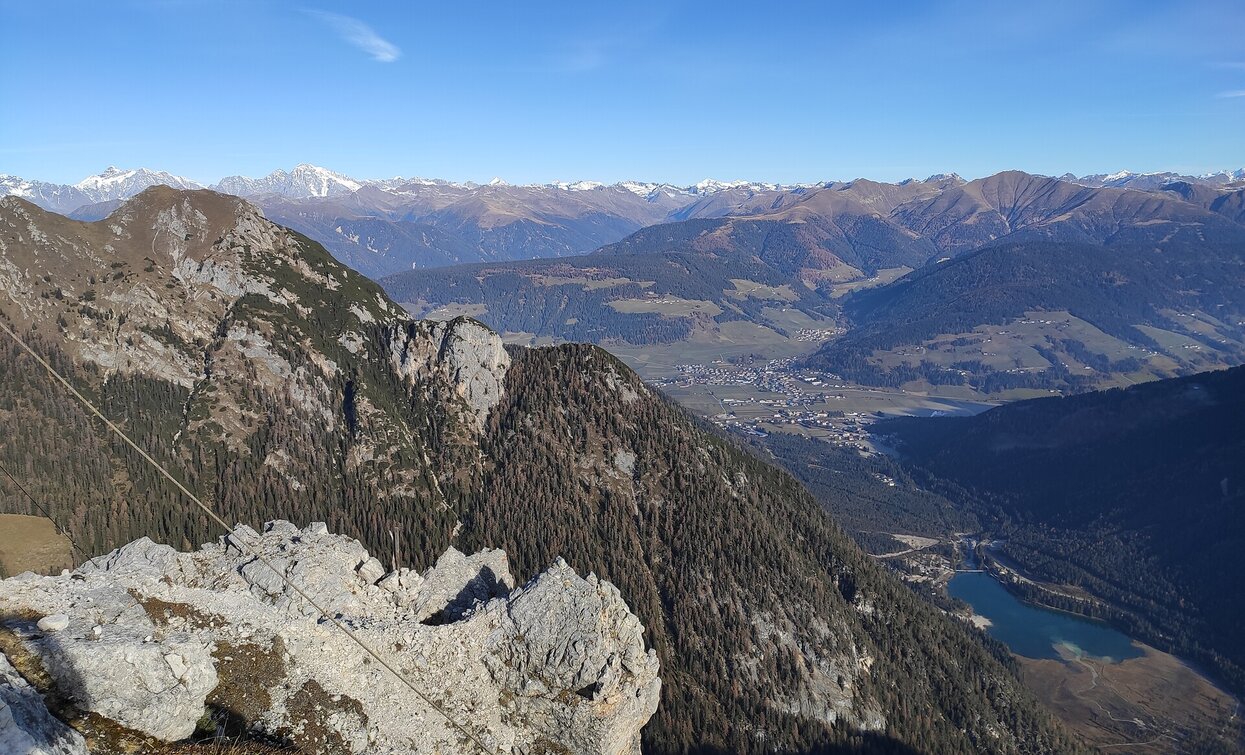
The Flodige is situated in the Nature Park Fanes Sennes Prags/Braies. From the summit you have a beatiful view over the Toblach/Dobbiaco lake and the village Toblach.

Route info
Difficult
Distance
5,2 km
Activity time
3 h 30 min
Ascent
1.079 m
Descent
60 m
Physical effort
Scenary
Highest point
2.324 m
Lowest point
1.312 m
Directions

The hike starts at the war cemetery in theHöhlensteintal/ Val di Landro valley. From there a path leads south to the power station, where on the right side the steep path no. 33 leads in the middle of the forest in bends towards the summit. Almost at the tree line there is a fork. The left path leads directly to the Flodige, the right leads first past the Flodige hut (closed) and then across the meadows up to the summit.

public transportation

Accessible by public transport. The timetables are available on www.sii.bz.it.

How to get there

How to reach Toblach/Dobbiaco: https://www.drei-zinnen.info/en/dobbiaco/dobbiaco/contact-and-service/arrival-mobility.html

From Toblach in southern direction until the War Cemetery.

Where to park

Parking places are available.

You might be interested in
Discover related tours
Altprags - Putzalm | © Kotter Steger, Braies
Intermediate
Add to favourites
Pragser Tal, Niederdorf
Summer hiking - Altprags/Braies Vecchia - Putzalm hut
Distance 2,4 km
Activity time 1 h 12 min
Ascent 363 m
Descent 56 m
Toblach, Pragser Tal, Niederdorf
Summer hiking tour - Braies Vecchia/Altprags - Moutain "Monte Serla/Sarlkofel"
Distance 4,9 km
Activity time 3 h 08 min
Ascent 1.010 m
Descent 59 m
Pragser Tal
Summer hiking ferrara - Monguelfo
Distance 6,7 km
Activity time 1 h 42 min
Ascent 37 m
Descent 152 m
Toblach
Summer hiking tour: View of the Three Peaks/Landro - Strudelkopf/Monte Specie
Distance 5,6 km
Activity time 3 h 00 min
Ascent 1.033 m
Descent 132 m
Toblach
Summer walk around: Rienz/Rienza - Gratsch/Grazze - "Grieswaldile"
Distance 4,3 km
Activity time 1 h 30 min
Ascent 58 m
Descent 58 m
Toblach
Summer hiking tour: Höhlensteintal/Val di Landro valley - Lückerleschartl/Forcella del Lago
Distance 5,3 km
Activity time 3 h 00 min
Ascent 1.280 m
Descent 90 m