to the cable cars

Winter hiking - Brückele/Ponticello - Plätzwiese high plateau

Pragser Tal
Add to favourites
Category
Difficulty
Intermediate
Activity time
2:18
Duration in hours
Distance
6.3
Distance in km
Status
Closed
Suggested period
Jan
Feb
Mar
Apr
May
Jun
Jul
Aug
Sep
Oct
Nov
Dec

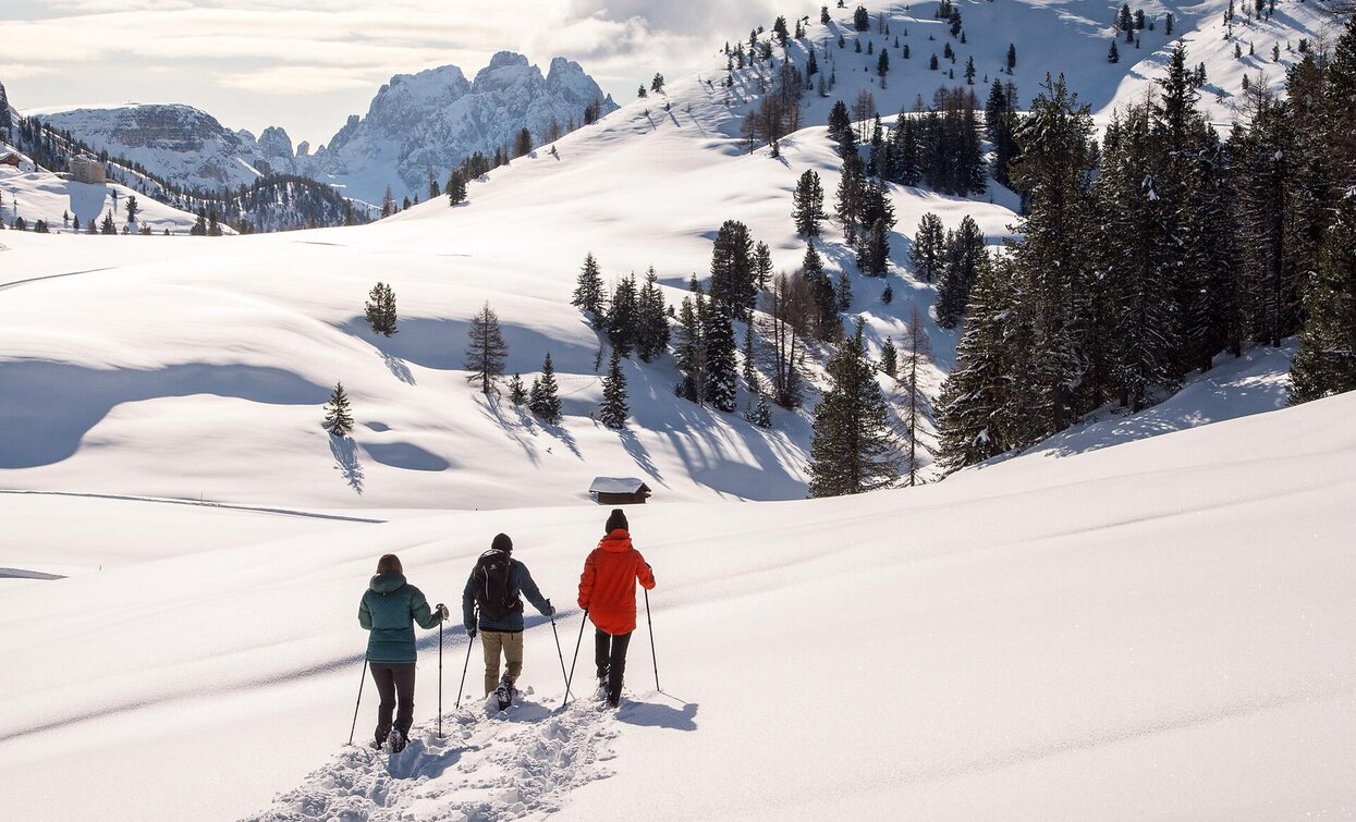
This hike leads to one of the most beautiful high plateaus in South Tyrol in the heart of the Fanes-Sennes-Braies nature park, which is a UNESCO World Heritage Site. Plätzwiese high plateau fascinates with an overwhelming view of the surrounding mountains of the Dolomites. Dominating everything is the northernmost 3000 metre peak in the Dolomites - the Hohe Gaisl (3146m).

Please note: Due to the temperature fluctuations, there may be icy patches on the trails and we therefore recommend the use of crampons!


Route info
Intermediate
Distance
6,3 km
Activity time
2 h 18 min
Ascent
561 m
Descent
65 m
Technical skills
Physical effort
Scenary
Highest point
1.990 m
Lowest point
1.494 m
Directions
From the starting point, follow trail no. 37 towards Plätzwiese high plateau. Always follow the markings to the right on the prepared path in the direction of Hohe Gaisl peak, slightly uphill through the beautiful Stolla valley to the Stolla hut of the same name, which is still traditionally managed as an alpine hut in summer and is also a popular excursion destination (1747m, closed in winter). From there, the trail climbs steeply for a short while before soon reaching the open and sunny Plätzwiese high plateau. Once at the top, a unique panorama opens up and the mountain huts invite you to linger.
public transportation

You can find all information about public transport on the website https://www.suedtirolmobil.info/en/#/

How to get there

Valley entrance Prags/Braies - road junction to Plätzwiese high plateau - continue until Brückele/Ponticello.

You can find all the information you need about accessibility on the website www.braies.bz


Where to park

At Brückele/Ponticello you can find a parking space.

You might be interested in
Discover related tours
winter Versciaco Vierschach | © Tourismusverein Innichen, San Candido
Intermediate
Add to favourites
Innichen
Winter hike: San Candido/Innichen - Versciaco/Vierschach - Prato Drava/Winnebach
Distance 6,6 km
Activity time 2 h 00 min
Ascent 11 m
Descent 60 m
Toblach, Innichen
Winter hike: San Candido - Costa dei Nosellari/Haselsberg - Dobbiaco
Distance 4,8 km
Activity time 2 h 30 min
Ascent 204 m
Descent 146 m
Toblach
Three Peaks View/Landro
Distance 1,5 km
Activity time 22 min
Ascent 9 m
Descent 9 m
Status
Closed
Valle San Silvestro | © @TVToblach, Dobbiaco
Intermediate
Add to favourites
Toblach
Winter walking tour: Panoramic path Frondeigen/Franadega
Distance 4,7 km
Activity time 2 h 30 min
Ascent 347 m
Descent 4 m
Status
Closed
Pragser Tal
Winter hiking tour - Schmieden/Ferrara Circuit
Distance 4,9 km
Activity time 1 h 22 min
Ascent 145 m
Descent 145 m
Status
Closed
winter trail | © Manuel Kottersteger / TV Niederdorf, Villabassa
Intermediate
Add to favourites
Niederdorf
Winter trail: "Schöne Aussicht"/Bellavista Eggerberg/Montecosta
Distance 5,7 km
Activity time 1 h 52 min
Ascent 360 m
Descent 90 m
Status
Closed