Hike: Val Campo di Dentro/Innerfeldtal Valley - Three Peaks

Toblach, Sexten, Innichen
Add to favourites
Category
Difficulty
Difficult
Activity time
4:30
Duration in hours
Distance
11.9
Distance in km
Status
Closed
Suggested period
Jan
Feb
Mar
Apr
May
Jun
Jul
Aug
Sep
Oct
Nov
Dec

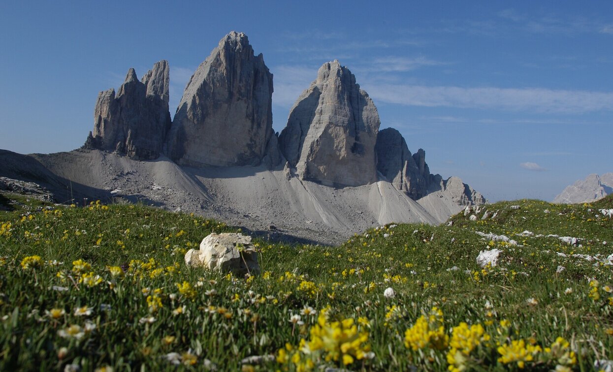
Quite difficult, but very beautiful hike, starting from the Val Campo di Dentro/Innerfeldtal Valley in the middle of the unique Three Peaks Nature Park. The path until the destination Three Peaks is entirely on the Alpine Dolomites Hiking Path No. 4. At arrival on Rifugio Locatelli/Drei-Zinnen-Hütte Mountain Hut you will have a stunning view of the Three Peaks.

Route info
Difficult
Distance
11,9 km
Activity time
4 h 30 min
Ascent
1.220 m
Descent
73 m
Physical effort
Scenary
Highest point
2.405 m
Lowest point
1.507 m
public transportation

Getting to the starting point of the tour by public transport is possible (bus number 446 to the bus stop "Abzw. Innerfeldtal / Bivio Val Campo di Dentro" and bus number 449 to "Antoniusstein").

How to get there

By car or by bus. Drive to San Candido in the Val Pusteria/Pustertal Valley and in the direction of Sesto. Between San Candido and Sesto on the right side there is the Val Campo di Dentro/Innerfeldtal Valley. At the valley entrance there is a parking.

You might be interested in
Discover related tours
Toblach, Niederdorf
Summer hiking tour: Toblach/Dobbiaco lake - Sarlkofel/Monte Serla
Distance 8,9 km
Activity time 3 h 30 min
Ascent 1.160 m
Descent 2 m
Status
Closed
Gandelle/Kandellen | © © DreiZinnenMarketing/M.Schönegger, Dobbiaco
Intermediate
Add to favourites
Toblach
Summer hiking tour: Toblach/Dobbiaco - Frondeigen/Franadega
Distance 4,8 km
Activity time 2 h 00 min
Ascent 400 m
Descent 0 m
Gsellwiesen | © Harald Wisthaler, Sesto
Intermediate
Add to favourites
Sexten
Hike: East Gsellrunde
Distance 10,1 km
Activity time 4 h 00 min
Ascent 645 m
Descent 645 m
Toblach, Sexten, Innichen
Hike: Val campo di Dentro- Forcella del lago (2.545 m) - Valle di Landro Innerfeld - Lückeleschartl 2.545 m - Höhlensteintal
Distance 15,9 km
Activity time 5 h 30 min
Ascent 989 m
Descent 989 m
Status
Closed
Lake Prags/Braies - Herrenstein | © Kotter Steger, Braies
Intermediate
Add to favourites
Pragser Tal
Summer hiking - Lago di Braies/Pragser Wildsee - Mountain "Sasso del Signore/Herrenstein"
Distance 4,0 km
Activity time 2 h 21 min
Ascent 739 m
Descent 8 m
Status
Closed
Altprags - Putzalm | © Kotter Steger, Braies
Intermediate
Add to favourites
Pragser Tal, Niederdorf
Summer hiking - Altprags/Braies Vecchia - Putzalm hut
Distance 2,4 km
Activity time 1 h 12 min
Ascent 363 m
Descent 56 m